MAY CONTAIN NUTS

Search Shorpy
SHORPY ART

Framed or unframed, desk size to sofa size, printed by us in Arizona and Alabama since 2007. Explore now.
Join and Share
Ad-Free Shorpy
Shorpy is funded by you. Patreon contributors get an ad-free experience.
Learn more.

Recent comments
- Texas Flyer wanted
- Just a Year Too Soon
- WWII -- Replacing men with women at the railroad crossing.
- Yes, Icing
- You kids drive me nuts!
- NOT An Easy Job
- I wonder
- Just add window boxes
- Icing Platform?
- Indiana Harbor Belt abides
- Freezing haze
- Corrections (for those who care)
- C&NW at Nelson
- Fallen Flags
- A dangerous job made worse
- Water Stop
- Passenger trains have right of way over freights?
- Coal
- Never ceases to amaze me.
- Still chuggin' (in model form)
- Great shot
- Westerly Breeze
- For the men, a trapeze
- Tickled
- Sense of loneliness ...
- 2 cents
- Charm City
- What an Outrage
- Brighton Park
- Catenary Supports
Member Photos
The Shorpy
Print Emporium
Print Emporium
Search Shorpy
Search results -- 30 results per page
- Homestead Scrappers: 1908
- ... Maybe from Lucy furnace.
(The Gallery, DPC, Factories, Railroads) ... Posted by Dave - 05/02/2018 - 1:03pm -
- Waiting for the Light: 1943
- ... locomotive classes over a given profile. Although some railroads reported CTE down to the last pound, any calculation more precise ... more detail if wanted.
(The Gallery, Jack Delano, Railroads) ... Posted by Dave - 03/19/2013 - 11:35am -
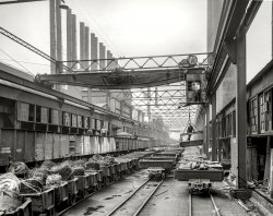
![Waiting for the Light: 1943 March 1943. "Kiowa (vicinity), Kansas. Train waiting for a block signal along the Atchison, Topeka & Santa Fe Railroad." Photo by Jack Delano. View full size.
Arm up?Isn't the signal up, which would signal clear? Help me here, please?
Highball?I'm no expert on reading signal aspects, but I believe it's displaying a "proceed."
Time to goThis retired railroader says proceed thru the block at prescribed speed.
I believeit's the Atchison Topeka & Santa Fe RailWAY.
Clear!Yes, that signal is displaying "proceed".
Grade Crossing AheadThere's not much to go on in this photo for figuring out the exact location, but just beyond the second signal there appears to be a hard line crossing the tracks from left to right. That might be the now-abandoned Missouri Pacific branchline to Hardtner, KS. Assuming that Rt. 2 follows the old MP right of way (it has some very railroad-like broad curves to it), then this photo was taken near the intersection of Main Street and Railroad Avenue in Kiowa.
As for the signals. The square ends on both signals visible would indicate that they are interlocking signals (which fits with that being the MP crossing up ahead) and not a manual block (round end) or automatic block (pointed end) signal. The other two posters (at this writing) are correct, the signals are set to clear. So, the description given is just writer's license.
PuzzlesPhare Pleigh makes good observations. There are more questions in my mind, though:
1. The far signal, on the pole, is on this side of the crossing - that is, it is beyond the crossing, and so does not govern moves over the crossing.
2. There is only one track at the far signal, so only one route should be possible. However, both signals are showing clear, which would mean conflicting (opposing) routes - which should not be possible.
3. The near switch is in front of the cantilever signal, so it is "outside" the interlocking; the signal does not govern moves over this switch. The second switch is "inside" the interlocking, and is protected by the signals. I would have expected to see another signal governing moves from this track, quite possibly a dwarf; I can't see one in the picture.
4. The far switch *should* be set for the other track, but again I can't see the position in this photo.
An interesting picture. And the train is probably waiting for a clear signal, since the signal on the cantilever is clear for a different train (I think).
Aspect not litI agree...Dave, we need a zoomed in view of the switch points in the background.
Also, I also will echo that the arms of the semaphores are in the clear position, however, I would have expected, even in bright daylight at this angle, to be seeing the clear light through the semaphore lens. It appears to be dark or just a little light (probably from the background) getting through it. With the bulb on the other side it should be brighter than it is.
edit: After tterrace's generous post of the zoomed photo, can we throw a monkey wrench into the comments and possibly say that the level crossing in the distance may not be a diamond but a vehicle crossing? I ask this as us railroaders would expect to see a signal protecting the other side of the crossing. Yeah, I don't see any crossing warning signs on either side of the main to warn vehicle traffic, nor any telegraph/phone lines paralleling the line, but I also don't see any bulky diamond hardware sticking out of the side of the mains rails as I do with the guard rail and switch point areas. This makes me believe this is a road crossing.
Also noticed that the locomotive probably is sitting on the main as there is a spring frog on the left main rail with the spring mechanics on both sides of the left rail and a visible flange gap on rail the locomotive is on.
[This is as big as it gets. - tterrace]
TrainspottedIt is a "Clear" Signal but you will notice:
1. It is on a cantilever station rather than on a pole similar to the signal a little farther down the track. That would imply that the signal is governing one of the tracks diverging off to the left. If it were for the track on which the locomotive stands it would likely also be on the pole. (Yes, I understand ATSF did use cantilever signals right next to the track they are governing).
2. The aforementioned pole signal is also showing a clear indication. Unless the signal system is malfunctioning it could not display this aspect to the track on which the locomotive is standing (not to mention the track that has the clear signal on the cantilever).
3. The answer seems to be that the locomotive is on an auxiliary track and that the signals govern the two tracks diverging to the left. The cantilever signal probably also governs the crossing at grade a short distance ahead.
Thanks!For all the info regarding how signals worked and how to understand the sources. A very intricate business indeed.
Engine LocationOk.. I'm going to go out on a limb and try to figure where this was taken. According to the shadows it appears we are travelling to the west. On the left side, marked by the row of telephone poles is Route 2 which runs between Attica, Ks and Kiowa, Ks. Very far ahead on the right hand side is, what looks like, a grain elevator. I think that is the grain elevator at Hazleton, Ks. The roads I cannot identify exactly because I can't determine distance by a photograph. There is a railroad cross marking immediately to the right. It doesn't look well travelled so, I will guess, it leads into a field. They still have those today. The next major road just beyond the signals could be Minco Road or Tri-City Road which is closer to Hazleton. I don't know of any other grain elevators between Attica and Kiowa. So, I think we are somewhere within a mile or two east of Hazleton, KS.
Another thoughtIt would seem likely that for one reason or another, the semaphore system was not in service at the moment this picture was taken. Is it possible the ATSF was in the process of installing the signal hardware, but had not yet put the system into service? Up until about 10 years ago the old Monon line (now abandoned) between New Albany, Indiana and Bedford, Indiana was controlled by semaphore indication. At some point shortly afterward the signal system was taken out of service and an order to that effect was issued. Train crews were instructed by the order to disregard the semaphores and be governed by DTC. I believe there are pictures on the web of what appear to be CP and INRD trains running “stop” semaphore indications in that territory. Regarding the Shorpy image, my guess is the train was running with timetable and train orders, waiting for an opposing train to clear the main at the far switch.
Why I love Shorpy!It's wonderful, the level of engagement we get, as folks chime in with these great details; always fascinating!
I'm just surprised no one has (yet!) counted rivets and kinks in lube lines and told us which locomotive this is.
I capitulatePiyer, I think you are right. I asked a good engineer friend of mine who basically said the same thing.
{Jim said} There are railroad diamonds that have no protection whatsoever; no interlocking signals, no manual gates, no stop signs. After viewing some aerial maps I've changed my mind and think that it is an unprotected railroad diamond crossing which no longer exists.
My guess of the track layout, judging from the placement of the signals, is that the mainline comes from the distance and continues on the farthest-to-the-left track visible in front of the steamer. The facing semaphore signal is to the left of center of the steamer's track and beyond the points of the closest switch and governs, I think, the facing movements on the far left track.
In the Bing aerial photo I've marked **PIYER, his attachment was EXACTLY the same place you linked!** what I think is the Santa Fe mainline (and the diverging branch at the wye) in blue, the yard or auxiliary track that the steamer is on in green and the middle track, which might be the Kiowa Siding, in yellow. I'm just assuming that the railroad crossing at the diamond, which I've marked in red, is another railroad and not just another Santa Fe line because of the overall track layout in the area.
And yes Dbell, I agree, that is one of the reasons I keep coming back here, the level of expertise and civility of the folks that comment here makes this just awesome.
Flat Pair SignalsThe masts of both of the signals have number plates, indicating they are Permissive Signals rather than Absloute Signals, and thus are block signals rather than part of an interlocking system. Unlike most other roads, on the Santa Fe square end signal blades were used on block signals.
The question then remains as to why the signal to the left would be showing a clear block when we know there's a train, as we are on it.
Close examination of a zoomed image shows that the points of the switch adjacent to that signal are aligned for the siding. The signal is showing that the route for which the turnout is lined, that is, the siding, is clear.
The signal in front of our engine also shows clear because we can proceed through the spring switch.
This was a signal system in wide use on sidings on the ATSF, which they called Flat Pair Signals.
An answer???Looking at BING, which is nice enough to include abandoned rail lines, I see that the MP line crossed the Santa Fe further south than I had original thought.
Flipping that map (http://binged.it/11eaawr) so that south is up and north is down, I think we are pointed in the same direction as the locomotive. Much has, obviously, changed over the years, but it would now seem that the interlocking signals aren't for the crossing but for the south leg of the Santa Fe's wye / branchline junction. If you allow that the yard might have originally been on the opposite side of the mainline so as to serve both main and branch lines, then this can fit with the image here.
As for the lack of signals at the grade crossing...
The line from Kiowa to Hardtner is / was (abd. 2002) the Kiowa, Hardtner & Pacific Railway from birth to abandonment, and merely operated by the MP. It is conceivable that the KH&P was dark territory and that trains had to stop clear of the crossing and get permission to cross from the Santa Fe dispatcher - a cheaper option than a manned interlocking, the expense of which, as the second railroad on the scene, would have typically fallen on them.
Final puzzle pieceFrom my timetable collection, I dug up Missouri Pacific system timetable #18 - October 25, 1981. According to this, the Hardtner branch crossed the Santa Fe a total of 7 times between Hardtner Jct. (Wichita, KS) and Kiowa in route to Hardtner. These crossings were protected by (n to s): a gate, a gate, a manual interlocking, a stop sign, a stop sign, a gate, and a manual interlocking. The last one presumably being the crossing we are looking at here.
Locomotive: Class 4000 Mikado(2-8-2), one of a group of 101 (4000 to 4100) built by Baldwin between 1921 and 1926 (Maybe there's another photo from Mr Delano from this set that shows the specific number?) and scrapped between 1950 and 1954. This is based on the "40" that I can see on the sand dome.
[Here you go. - tterrace]
Colour?I know nothing about trains, but I do know the train community is *very* specific about making sure train colours are correct especially in black and white photos. Anyone got a colour reference for the train?
More photos & cluesHere are several other helpful photos from this set. The opposite side view shows more of the track layout and another has the engine detail.
Piyer, I'd say you're right on target in the BING photo! The LOC photos DO show the yard on the wye side of the main. Presumably as train lengths increased, the sidings couldn't be lengthened on the town side of the tracks, so the whole shebang was flip-flopped. Topo maps show remnants of a road in that location going from the present adjacent farmhouse across the tracks to the former airstrip, and a curved track bridging the wye ends (that scar still visible).
That is definitely a crossing with another railroad. Look at the height of the telephone poles on both sides. In 1943, highways didn't get such vertical clearances, plus, there are tie ends barely visible "behind" the far signal. There are also 2 vertical "somethings" just to the right of the cantilever mast (one near each track).
In the cab window view, the far switch points are definitely reversed toward the wye (and apparently the cantilever is reflecting that route). That much just makes sense. (all this more visible in the massive LOC TIFF images)
Mystery solved?
ATSF 4097According to information available to me, ATSF 4097 was built by Baldwin Locomotive Works in 1926, construction number 59398.
For those not familiar with railroad terminology, I have written out the following information in long form. I recognize many of these details will be of more significance to locomotive historians who would be satisfied with the usual technical shorthand.
Principle dimensions:
cylinders: 27 diameter, 32 stroke, in inches
driving wheel diameter: 63 inches
working pressure: 200 pounds per square inch
calculated tractive effort: 63,000 pounds*
weight on drive wheels: 260,200 pounds
total locomotive weight: 342,000 pounds
tender capacity: 5,000 gallons oil; 15,000 gallons water
tender weight, fully loaded: 298,600 pounds
total wheelbase, engine and tender: 79 feet, 1.875 inches
total length over coupler pulling faces: 89 feet, 9 inches
Like all locomotives in the '4000' Class, it was built with a Schmidt superheater, Walschaert valve gear, Elesco feedwater heater (except 4007) and Delta trailing truck.
It was built as an oil-burner.
It was sold for scrap to Commercial Metals Co. on 27 January 1956.
GENERAL NOTES: Dimensions given are typical for the 1926 Baldwin-built locomotives (4086-4100) and do not necessarily apply to any specific locomotive at a specific time. It would be surprising if any locomotive matched the dimensions exactly even when new. In particular, recorded weights could vary significantly between rolling the same locomotive off and then back onto a scale. Weight on drive wheels varied with spring tension (in the suspension system) and changed with wear or simply shop setting.
*-The dimension seemingly of most interest to railfans is also the least relevant -- that of calculated tractive effort (CTE, usually shortened to tractive effort=TE). As the name implies, it is a theoretical calculation of the maximum amount of force available to be applied at the driving wheels. It is, at best, vaguely accurate for comparison purposes between locomotive classes over a given profile. Although some railroads reported CTE down to the last pound, any calculation more precise than the nearest thousand pounds was pure fiction. In fact, the ONLY way of determining what a locomotive can haul is by controlled road tests using a dynamometer car.
Those already interested in the ATSF will no doubt already know my sources, primarily S. R. Wood and E. D. Worley. I can provide more detail if wanted.
(The Gallery, Jack Delano, Railroads)](https://www.shorpy.com/files/images/SHORPY_8d26661a.thumbnail.jpg)
- Point Bridge: 1900
- ... 2011.
(The Gallery, Boats & Bridges, DPC, Pittsburgh, Railroads) ... Posted by Dave - 08/03/2012 - 1:37pm -
- Union Station: 1905
- ... it all in later years.
(The Gallery, Boston, DPC, Railroads) ... Posted by Dave - 07/29/2012 - 10:09am -
![Union Station: 1905 Boston, Massachusetts, circa 1905. "North Station." An update of this view. 8x10 inch dry plate glass negative, Detroit Publishing Company. View full size.
Re: No One RidesThat made my day. You gotta wonder where people get their ideas about how people lived in olden times. Cowboy movies? "Little House on the Prairie"?
Can I use my Metro card?Except for issues of infection, illness and a change of clothing, I think most modern city dwellers would fit into this scene nicely. How much for a street car ride?
Remember Mr Kane's friend Mr Bernstein's memory of the girl in the white dress? We old men remember the girls in white dresses. I'd tip my hat, too.
No One RidesIt is interesting to note that in so many of these old photos there are horse and wagons, yet no horseback riders. I wonder if there was some kind of special tax on horseback riding, because you don't even see hitching posts. I certainly would have ridden on a horse vs walking. Very strange indeed.
[All those streetcars you see in these pics -- they are for those 99 percent of city dwellers who didn't own a horse. - Dave]
Saddling UpTo Ride a Horse: first you have to keep the horse. In the city or town, this could well be at some livery stable at some distance away, unless you had a small estate. You have to feed and water the horse, shovel the manure, and clean the hooves daily, putting up with flies and bad smells all the while. And where shall we keep the hay and oats? To ride, we must bring out the horse, brush down, apply saddle blanket, get saddle, put on horse, pass girth underneath, lash up to saddle rings, pull tight, get the bridle on, retighten the girth, make sure the horse is reasonably happy with all this, and finally, mount. Reverse entire process when returning home. Horses were necessary in the country but smooth-running, clean electric transit was justifiably very popular in the city. Wagons of course were needed for hauling freight, and the rich could afford a carriage and driver.
Nice to see a couple of polite men.Even in a busy Boston street there are two men who acknowledge a lady passing.
Re: No one rides no. 2That's why I love this site and read all comments. Pondering all the photo details and anomalies makes us question our assumptions about how things were done in the past, and perhaps question present practices too. I enjoyed both the original question and the explication from Dr Q.
Horseback RidingThere are lots of old pictures of people astride usually in a big park with a bridle path. Generally only the wealthy could maintain a riding mount and riding was considered a pastime/sport. I'd love to see some pics of Durlands Riding Academy in Manhattan on here!
[They're already here! - Dave]
The GahdenFuture site of the Boston Garden (and present site of its replacement, the "TD Garden"), home of Cousy, Russell, Heinsohn, Havlicek, the Joneses, Cowens, Bird, DJ, Chief, McHale, The Big 3, et al. Not to mention Orr, Espo, Bucyk, Sanderson, and the rest of the Big Bad Bruins of the 1970's. North Station today still functions as the southern terminus of the North Shore commuter rail line, but the train station part of the building is essentially invisible from the street. Nothing like the Transportation Temple of yesteryear shown in the photograph. Regardless, Causeway Street is full of pedestrian traffic every day, and many nights, in much the same way as it was 105 years ago. One of those irreplaceable urban gathering places.
Horses in the CityEven Paul Revere, a successful merchant, didn't bother keeping his own horse in the city. He borrowed Brown Beauty from John Larkin across the river in Charlestown. It must have been a lot like having a car in the city is now; unnecessary and too much trouble for most. Although I have seen the remains of what look like they may be horse stables in Richmond which are now used as sheds.
Two Depots in OneThe section at far left was once the Boston & Lowell RR depot. The center (North Union Station section) was an addition. A very LARGE addition! Far better then the buildings that replaced it all in later years.
(The Gallery, Boston, DPC, Railroads)](https://www.shorpy.com/files/images/4a17829a.thumbnail.jpg)
- Blind Curve: 1941
- ... at me.
(The Gallery, Landscapes, M.P. Wolcott, Railroads) ... Posted by Dave - 06/18/2020 - 3:42pm -
- Beacon Beckons: 1902
- ... sharing an anecdote.
(The Gallery, DPC, Landscapes, Railroads) ... Posted by Dave - 02/09/2019 - 2:33pm -
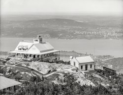
- Standard Service: 1940
- ... Gallery, Cars, Trucks, Buses, Gas Stations, John Vachon, Railroads) ... Posted by Dave - 11/14/2019 - 11:35am -
![Standard Service: 1940 April 1940. "Gas station on a sunny afternoon. Dubuque, Iowa." Medium format acetate negative by John Vachon for the Resettlement Administration. View full size.
Hairy CatConsidering the Cat's hair in this self-portrait (https://www.shorpy.com/node/25187), I wonder if Mr. Vachon was peering over the camera and looking at the lens (or out the window) the moment this exposure happened.
[He was looking down into the viewfinder. - Dave]
That does double for me!I loved all my twin-lens reflex cameras and wish I had kept them. But nnnnoooooo ...
Current view?The Page Hotel, located in the upper left, was located at the corner of Fourth and White streets. This view from Google Maps, appears to show approximately the same view. Not sure if the existing brick building across the tracks is the same one in the current view.
U.S. 61 Freeway There NowBased on this article, the Page Hotel stood at Fourth and White Streets, about where the U.S. 61 freeway is now.
http://www.encyclopediadubuque.org/index.php?title=PAGE,_John
Heavy metalBeing a steam locomotive fanatic, I would want a room facing the tracks in the hotel. Unfortunately I wouldn't be born until Nov. of 1940. Looks like a busy crossing and with the baggage carts must be right at the depot.
John VachonJohn Vachon's FSA pictures are sadly underrated. He was highly influenced by Walker Evans, whose plain and unpretentious portraits showed little evidence of advocacy or drama. Vachon had the same style, but his subject matter often differed from that of Evans. Vachon was young and inexperienced when he was hired by FSA head Roy Stryker. He fell in love with the camera, and loved touring the country for the first time. He photographed just about everything he saw, in this case a gas station near the railroad tracks. Consequently, his vast collection of pictures has become a valuable document of how life and the built environment looked in the 1930s.
If you build it they will comeIt's kind of hard to see but if you follow the road (4th Street) from the bottom towards the top of the picture you will see a baseball stadium in the distance. It was known alternatively as Municipal Stadium, 4th Street Stadium, or John Petrakis Park. It was built in 1915 and was razed sometime in the 1970s, I believe. It hosted several minor league ballclubs.
Double visionUnlike commenter Jim Page, I'm a newcomer to twin-lens reflex cameras, having started to collect them last year. I found this image of Jack Delano somewhere in cyberspace. I believe that's a Zeiss Ikon Ikoflex around his neck. Being a serious fan, I just had had to buy one.
Gas PricesWhat's up with the sign? Prices? Octanes?
[Yes. - Dave]
Photographer's viewpointWell, we can see where the photo was taken from in radiochris's modern shot.
There was a fire here, tooThe six-story brick building shown in the "Current View" post is the Canfield Hotel, built in 1927 as an addition to the existing four-story wooden structure. In 1946 a fire destroyed the older wooden building, killing 19 people, including owner William Canfield. The picture would have been taken from the four-story wooden part. An account of the fire:
http://www.encyclopediadubuque.org/index.php?title=CANFIELD_HOTEL
(The Gallery, Cars, Trucks, Buses, Gas Stations, John Vachon, Railroads)](https://www.shorpy.com/files/images/SHORPY-8c16972a.thumbnail.jpg)
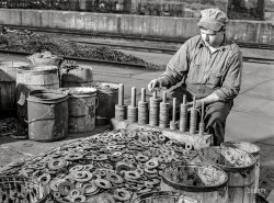
- Desk Job: 1942
- ... Was the Stacking rings.
(The Gallery, Albert Freeman, Railroads, WW2) ... Posted by Dave - 02/01/2018 - 2:11pm -
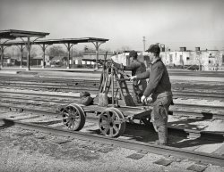
- Self-Propelled: 1940
- ... pump your way along the track!
(The Gallery, OKC, Railroads, Russell Lee) ... Posted by Dave - 07/20/2018 - 11:43am -
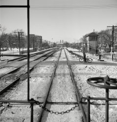
- Bicycle Crossing: 1943
- ... Elmhurst either.
(The Gallery, Bicycles, Jack Delano, Railroads) ... Posted by Dave - 12/11/2014 - 12:07pm -
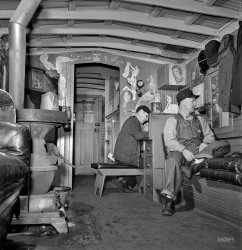
- Man-Cave Caboose: 1943
- ... experience.
(The Gallery, Jack Delano, Pretty Girls, Railroads) ... Posted by Dave - 10/21/2013 - 10:25am -
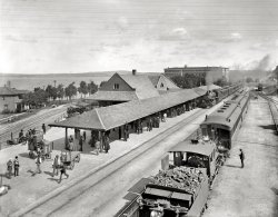
- Scenic Petoskey: 1908
- ... the way I remember it.
(The Gallery, DPC, Petoskey, Railroads) ... Posted by Dave - 07/29/2012 - 6:12pm -
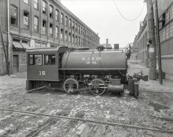
- New Jersey Zinc: 1911
- ... likely the former.
(The Gallery, Factories, Mining, Railroads) ... Posted by Dave - 06/21/2016 - 10:54am -
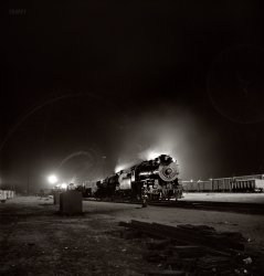
- Night Train: 1943
- ... with their jointed boilers.
(The Gallery, Jack Delano, Railroads) ... Posted by Dave - 01/07/2013 - 3:46pm -
- St. Clair Tunnel: 1905
- ... automobile tunnel was third.
(The Gallery, DPC, Railroads) ... Posted by Dave - 08/21/2012 - 12:01pm -
![St. Clair Tunnel: 1905 Port Huron, Michigan, circa 1905. "St. Clair Tunnel." Oh, and please note: "No Admittance." 8x10 inch glass negative, Detroit Publishing Co. View full size.
Signaled block systemDoing just a little research, I discovered traffic through the tunnel was controlled by a signaled block system. The train dispatcher shared quarters with the block system equipment on the Sarnia side, and the building in the picture housed the equipment on the Port Huron side. It appears to be that the switch was an early dual control, subject to remote operation by a control operator, and also to hand operation by train crews as circumstances warranted. Great snippet of railroad history.
Tempting Yeah, fer sure, I wanna be in that tunnel when a train comes through. Not likely!
The first one !According to Wikipedia, electrification of the St.Clair tunnel was completed in 1908. Maybe some astute railfan could verify this? Also this was the first full-sized underwater railroad tunnel built.
Who do you believe?Interesting discrepancy. The year of this photo is 1905 but some detailed historical research indicates that electric trains didn't start running until 1908. The contract to electrify the tunnel wasn't awarded to Westinghouse until 1906.
http://loc.gov/pictures/item/mi0363/
(relevant bit about electrifying the tunnel is on page 32 of the report. Click the Data Pages link)
[The "year of the photo" is not 1905 but, as noted in the caption, "circa 1905." Meaning around, in the general vicinity of. - Dave]
AdvertisingCould it be that the lettering on the lawn is an early form of advertising to be seen from the air?
[I don't think so. - Dave]
102 years laterThis is how it looked in September 2007.
Sometimes a Tunnel is just a TunnelCould this BE more Freudian?
Long and LastingThis tunnel was over 6000 feet long and was in use from 1891 through 1994. It was replaced by a tunnel with the same name in 1995.
Life imitates artThis makes me think of Alfred Hitchcock.
See the movieGo to the following link to see an Edison-Biograph film made between 1896 and about 1905:
http://www.youtube.com/watch?v=EQzXCoQRbas
At 4:01-4:51 the camera is mounted on the front of a locomotive going through St. Clair Tunnel. The film was made before the above photo, because the railroad is not yet electrified. [You actually go through the entire tunnel; the film negative is reversed to see the interior of the bore.]
The rest of film is full of some neat eastern railroading too. Sort of like seeing some of Dave's old photos starting to move...
Sometimes a tunnel is just a tunnel.Sir Alfred Hitchcock liked these shots bunches! And he used them too.
Hey, Sleepy!Welcome to Shorpy. But wake up and pay attention. In particular r-e-a-d the captions. Dave let you off light. This time.
Freudian SlipTrain + Tunnel = SYMBOLISM!!
The lawn letteringTo be viewed by passengers on the other rail alignment, visible to the upper right.
St. Clair River Tunnel
The Railroad and Engineering Journal, Volume 62, 1888.
The St. Clair River Tunnel. — After a long period of waiting, work on the proposed tunnel under the St. Clair at Port Huron is again actively under way. The developments so far are most satisfactory, the measurement showing more than the required thickness of clay everywhere, with no fault or break discoverable. The shoe on the American side was successfully put in place recently, and the shaft is now being excavated.
On the Canadian side good progress is being made, and the brick lining has been lowered by successive drops of from 4 to 8 ft. each, until it is now half way or so to bed-rock. A blower for forcing air down the shaft and the electric light plant of the machinery will soon be in place.
The tunnel is to be built by a separate company, but will be used by the Grand Trunk Railway trains.
Encyclopædia Britannica, 1891.
River Tunnels. — Small tunnels under navigable streams are quite frequent in the United States. In Chicago a number have been bored under the Chicago River in order to connect the several parts of the city without bridges. The project of a tunnel under the Detroit River, through which railroad traffic should be carried without interfering with navigation, has long been discussed. Various towns have, from time to time, been selected as sites for the beginning of operations. At Port Huron, some miles above Detroit, the River St. Clair is now being tunnelled in order to avoid the carrying of cars upon railroad ferry-boats. When completed, the tunnel will shorten the distance between Buffalo and the cities of Detroit and Chicago. It will be over a mile in length, 2310 feet being under the river, 1810 feet under dry ground south of the city limits of Port Huron, and 1160 feet on the Canadian side; 1500 feet of the portion under the river will be almost level, falling eastward only enough to cause the water that leaks into the tunnel to run to the Canadian side. The total length of the ascent on the American side will be 4900 feet, and on the Canadian side 4970 feet. The length of the open cutting or approach at the Port Huron end of the tunnel will be 2820 feet, and at the Canadian end 3270 feet. The depth of the lowest part of the tunnel below the surface of the water will be 81 feet, which is 15 feet higher than had been at first expected, on account of anticipated quicksands and water-pockets. The minimum depth of the top below the bed of the river will be 15 feet. The tunnel has a clear internal diameter of 20 feet, and is intended for a single track. A double-track tunnel was at first proposed, but it was found that two single-track tunnels could be built at less expense than one doubletrack. Should this tunnel prove successful and profitable, the company intends to build a second one. The cost of the tunnel is estimated at $1,500,000.
Souvenir History of Port Huron, Michigan, 1906.
… the most notable and absorbing sight are the great St. Clair Tunnel engines, which were built expressly for taking heavily loaded trains through the great underground international railway thoroughfare. You enter a well-appointed car and take a seat the bell rings, and the great train soon begins to trundle away toward the approach to the largest submarine tunnel in the world. Broad banks of blue clay rise on each side, abutted with heavy stone masonry. The train increases its speed, and if you can get near the rear car door of the last coach when the train plunges into the tunnel and a moment after daylight is changed for darkness, the opening which you have entered as it recedes looks like a beautiful landscape placque hung upon a wall of inky darkness. The train thunders on, and in less time than you can describe the trip the express commences to climb the grade on the Canadian side and has stopped at the Sarnia depot, and you have ridden through a tunnel measuring 6,025 feet from portal to portal. and under the greatest water highway of the world.
FirstThe St. Clair Tunnel was the world's first underwater tunnel between two nations. The Michigan Central Tunnel between Detroit and Windsor was the second and the Detroit-Windsor automobile tunnel was third.
(The Gallery, DPC, Railroads)](https://www.shorpy.com/files/images/4a23392a.thumbnail.jpg)
- Cozy Depot: 1943
- ... View full size.
(The Gallery, Jack Delano, Railroads) ... Posted by Dave - 01/08/2014 - 10:29am -
![Cozy Depot: 1943 January 1943. "Freight train operations on the Chicago & North Western Railroad between Chicago and Clinton, Iowa. At the end of the trip, conductor John Wolfsmith [last seen here] waits at the little railroad station for a suburban train to take him back home to Chicago. A welder who works at the rip tracks is trying to thaw out his frozen air hose." Medium-format negative by Jack Delano for the Office of War Information. View full size.
(The Gallery, Jack Delano, Railroads)](https://www.shorpy.com/files/images/SHORPY_8d24470a.thumbnail.jpg)
- Rust Belt Riviera: 1941
- ...
(The Gallery, Industry & Public Works, Jack Delano, Railroads) ... Posted by Dave - 11/06/2019 - 1:36pm -
- Sawdust Memories: 1936
- ... history.
(The Gallery, Arthur Rothstein, Factories, Railroads) ... Posted by Dave - 05/26/2019 - 1:34pm -
- Incline Saloon: 1907
- ... the car.
(The Gallery, DPC, Duluth, Eateries & Bars, Railroads, Streetcars) ... Posted by Dave - 08/13/2012 - 6:45pm -
- Inside Track: 1943
- ... Gallery, Baltimore, Cars, Trucks, Buses, Marjory Collins, Railroads) ... Posted by Dave - 03/17/2014 - 6:46pm -
- Robert Hill: 1943
- ... occupation "Machine Labor".
(The Gallery, Jack Delano, Railroads) ... Posted by Dave - 06/25/2009 - 1:57am -
![Robert Hill: 1943 March 1943. "Topeka, Kansas. Robert L. Hill, steel car repairer and rivet driver, at the car shops of the Atchison, Topeka and Santa Fe Railroad." Medium-format nitrate negative by Jack Delano, Office of War Information. View full size.
Wonderful portraitI'd echo allie's sentiments. Mr. Hill's handsome, dignified face and bearing reveal something about his character, at a time when many of his countrymen regarded him as a second-class citizen.
I hope this image has been copied to a more stable and durable medium, for posterity, than the nitrate it was captured on.
[These images have all been copied and preserved by digitization. - Dave]
CastingSamuel L. Jackson will play him in the movie.
What a portrait!I hope Mr. Hill's grandchildren have copy of this photograph. It is such a beautiful image of this gentleman. My grandfather was a welder, but passed away before I was born. The only photos I have of him are of a frail old man. I would love a photo of him in his prime, like this one.
RivetingI love this man's face. It's a face of courage and a proud dignity. I would have liked to have known him.
Robert L. Hillhttp://en.wikipedia.org/wiki/Robert_L._Hill
Same name, born 1892 in Arkansas, fled to Kansas and worked in a meat plant in Topeka.....
Could this be Robert Jr.?
Heck, if he is 51 this is Robert Sr.!
Robert Hill -- 1940 US CensusRobert Hill, born about 1900 in Arkansas, was married to a Mattie (born about 1903, in Arkansas).
Five children, two boys named Wilson (age 17, born in Kansas) and Earl (13, born in Kansas), and two daughters, Viola (age 21, born Arkansas), and Georgia (age 19, born in Kansas). There's an infant named Winifred, age 2 months, listed in the household. Her relationship is not stated, but as she's listed directly under Viola, it's probably her daughter, making her Robert's granddaughter.
They lived at 608 East 18th Street in Topeka, and owned their own home (value $1,200). Robert earned $1,728 in 1939 ($28,000-$29,000 adjusted for inflation to 2013 dollars), making him by far the best paid man on his census page.
Employer is listed as the Santa Fe Railroad, of course, his occupation "Machine Labor".
(The Gallery, Jack Delano, Railroads)](https://www.shorpy.com/files/images/8d26557u.thumbnail.jpg)
- Cow Town: 1943
- ... to sleep many nights.
(The Gallery, Jack Delano, Railroads) ... Posted by Dave - 09/05/2012 - 6:07pm -
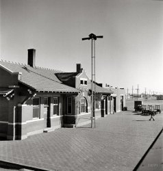
- Despatch Depot (Detail)
- ... to text Aunt Minnie over in Elmira.
(The Gallery, DPC, Railroads, Rochester) ... Posted by Dave - 03/07/2018 - 3:18pm -
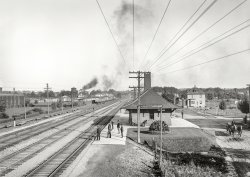
- Mourning McKinley: 1901
- ... a park now.
(The Gallery, D.C., D.C. Street Survey, Railroads) ... Posted by Dave - 02/03/2021 - 10:29am -
![Mourning McKinley: 1901 Washington, D.C. "View from Randall School of H Street S.W., between Half & First Streets, in 1901 showing coal yard and old homes near railroad station. Houses have McKinley memorials. Portrait of President William McKinley draped in black is visible on the house on the left. A flag is at half mast on the right." Along with at least two other McKinley portraits. 8x10 inch glass negative, D.C. Street Survey Collection. View full size.
Oddly lonelySuch a stark contrast exists between the pretty house with delicate embellishments casting lacy shadows -- the two older folk porch sitting on an early autumn afternoon; the younger woman dressed like an Old West frontier female standing by, arms crossed; the hatted child playing at the edge of the sidewalk -- and the rest of the landscape, which appears suspended in a dusty, lonely languor.
McKinley's destinyThe assassination of William McKinley made Theodore Roosevelt President at the age of 42. When TR became Vice President earlier that same year, his friend Charles G. Washburn remarked: "I would not like to be in McKinley's shoes. He has a man of destiny behind him."
Buffalo / DallasI was 7 when President Kennedy died. I never hear mention of Dallas without thinking of his assassination. I've always wondered, did people who were alive when McKinley died have similar associations with Buffalo, where he was assassinated?
TRElsewhere in the city, "that damned cowboy" Teddy Roosevelt has just become the new President.
All the houses with TepeesI had always assumed that the little turrets, or cones on the corners of houses were purely for appearance. I wonder whether they also played a structural purpose since more than two dozen of them are visible in the picture.
McKinley's DeathWhen he died President McKinley was widely and deeply mourned. The trappings of official and Victorian mourning with black crape and formal mourning attire were everywhere. But so also were touching demonstrations by simple people throughout the country where public assemblies and special services in churches were held. The route of his funeral train was lined by ordinary working class people standing shoulder to shoulder with the well off and powerful. People placed coins and flowers on the train tracks and kept the flattened remnants as mementos. At almost every stage of the journey local bands appeared playing the hymn "Nearer My God to Thee," a popular hymn and Mr. McKinley's favorite long before it became associated with the Titanic disaster. McKinley was a deeply religious man and according to popular legend (disputed) his last words were from the opening verse of the hymn.
Here is a link to some rare film footage of the official ceremonies and funeral procession. https://youtu.be/gTQrpsZ3tQA
LOCIs that the Library of Congress in the distance on the left?
Ballast = coalI believe we're looking at a coal dealer. Note that some of the bays are divided so the coal can be sorted as to lump size and possibly some choice Anthracite in there.
Seems to be a small cart-ramp extending over yet more bays below.
Displaying FlagsFlags are flown at half mast aboard ships. On land they are flown at half staff.
Jefferson BuildingThe partially visible large building in the upper left of the image is southeast corner of the Jefferson Building of the Library of Congress, which was completed four years before the image was taken.
Lehigh ValleyThe elevated rail arrangement and piles of ballast in the center-right of the photo remind me of all the comments and speculations last week with regard to Earth Movers: 1901.
Building IDI'm curious about the complex of large white (at least in this picture) buildings in the upper right. Can we identify that?
It's on the MapGoats of Venus has indeed got it right. [As does the photo caption, which calls it a coal yard - Dave] A look at a 1904 Sanborn Fire Insurance map shows this to be the Allegheny Coal Co. The map clearly shows the hard and soft coal trestles as well as the other structures on the site. Even more fascinating, it matches up perfectly with the houses in the image (facing H Street) and accurately shows their construction, with the pink color representing brick and yellow being frame. Even the 2-story frame porch on the house in the foreground is shown on the map as well as the split brick and frame construction of the first house around the corner on Half Street.
Building ID FoundAfter much sleuthing, including trying to get the right perspective using old DC maps, I can positively identify the large white building in the upper right as being the “old” Providence Hospital located at the time at 2nd & D Streets SE on Capitol Hill (see the image in the plaque below).
I’m a bit embarrassed it took me so long to figure it out--I was born there in 1950. Dating to the Civil War era, the hospital moved in the 1950s to larger quarters in Northeast. The buildings in the photo were razed and site became Providence Park, which still exists today. Incidentally, a number of previously published Shorpy photos were taken around the same time frame from the roof of the hospital, including several pointed back in the general direction of the Randall School—the reverse of where we’re looking from in the photo above.
The fall of a sparrowThe prominent group of structures at 2 o'clock is the old Providence Hospital complex. It's a park now.
(The Gallery, D.C., D.C. Street Survey, Railroads)](https://www.shorpy.com/files/images/SHORPY-40417a.thumbnail.jpg)
- Ironwood: 1899
- ... and it finally arrived!!!
(The Gallery, DPC, Mining, Railroads) ... Posted by Dave - 08/21/2012 - 5:58pm -
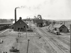
- Rest Stop: 1904
- ... the rails directly to the ties.
(The Gallery, DPC, Railroads) ... Posted by Dave - 04/22/2017 - 7:30pm -
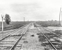
- Iron Man: 1941
- ... a beautiful scene.
(The Gallery, John Vachon, Mining, Railroads) ... Posted by Dave - 05/17/2014 - 11:40pm -
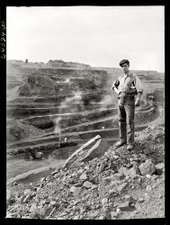
- New Jersey
- ... M&E's trek westward.
(ShorpyBlog, Member Gallery, Railroads) ... Posted by John.Debold - 09/18/2011 - 10:33pm -
- Retarder Tower: 1942
- ... today.
(Technology, The Gallery, Chicago, Jack Delano, Railroads) ... Posted by Dave - 06/03/2013 - 9:31pm -
![Retarder Tower: 1942 November 1942. "Chicago, Illinois. South classification yard seen from retarder operators' tower at an Illinois Central Railroad yard." Medium format nitrate negative by Jack Delano for the Office of War Information. View full size.
Fantastic imageI admit I am a railroad "groupie", but this picture is incredible.
Jack Delano may be the Ansel Adams of railroad images.
The ultimateTrain Set.
Not a groupieBut a rail fan like me and many others who love trains, would this be Markham yard on the IC? (IC the train)
Something to considerAs we enjoy these photos, we should give a tip of the hat to the photographers who often risked life and limb to make them. In this Delano photo take a look at the tower off to the left. I've been in such towers, and whether Jack had to climb up a straight ladder or take an outside spiral stair, there are spots with no handhold and the top higher than it appears. Bulky photography equipment in those days would probably have hung from his body by rope as he climbed or pulled up hand over hand by rope - no easy task. Then they had to produce artistic photos and develop them carefully. Devoted people!
[In this case, Delano was shooting 120 roll film, most likely using a camera similar to the one he's shown with here. -tterrace]
The Proviso YardsActually located in west suburban Hillside, Illinois. These yards are 1/2 mile from where I grew up in the 50s and 60s.
I bet you're right, ferrochrr. All the big yards in the "rail hub of the country" begin to look alike!
Proviso?Proviso yard would be C&NW RR, (UP RR today) not the IC, as for climbing up into RR towers, they were not hard to do, sure the stairs could be a little steep, but certainly not difficult to manage. I've been in a few towers myself for photo opportunities as well.
Connection queryCan someone explain how the levers on the control panel were connected to the switches in the distance? Looks to me as if only a few inches of movement on the lever would activate a switch on the rails that must have been relatively large. How was it done? Cables? Motors? Is the same principle used in modern railroading?
LeversTo answer some questions, the levers in this photo were connected to the points by means of electrical connections. Previously they were mechanical, in that the levers pulled a number of point rods that activated the retarders and switch points. Sometime around 1930, IC upgraded their systems to a more modern type that used motors and electrical impulses to activate things. Believe it or not, though largely modernized, a similar system is still in use today.
(Technology, The Gallery, Chicago, Jack Delano, Railroads)](https://www.shorpy.com/files/images/SHORPY_8d23233a.thumbnail.jpg)
- The Dining Car: 1902
- ... and I often heard those as a kid.
(The Gallery, DPC, Railroads) ... Posted by Dave - 07/18/2012 - 7:03pm -
![The Dining Car: 1902 Circa 1902. "Delaware, Lackawanna & Western Railroad dining car." 8x10 inch dry plate glass negative, Detroit Publishing Company. View full size.
More on The SilverwareI believe that the waiter would set the appropriate utensils for each course from the attractive arrangement. There isn’t a lot of room at these tables and I have been to restaurants where the waiter set the silver before each course.
Strange Display?The Silver Ware display on the tables looks awfully strange...wonder why that was placed that way?
DL&WThis is what train buffs call "High Varnish." Mighty nice.
I'm pretty sure I haven't missed an opportunity, every time the DL&W is featured here, to mention that when my grandmother rode that line, over 100 years ago, they all said that the letters DL&W stood for Delay, Linger and Wait.
Style of Long Ago....Incredible elegance that was probably taken for granted back then. Superbly designed (notice the condiment racks on the bulkheads), hat racks, nighttime dining with electric lights overhead. And electric fans! What will they think of next. The use of mirrors that visually make the dining car larger than it appears. This dining car appears to have it all! The man in the aisle does have a bit of a ghostly appearance, though.
According to Lucius BeebeThe varnish diners were meant to give the traveler the same dining experience as the First Class hotel they left and the one they were traveling too.
Re: Strange Display?I didn't notice it at first, but you are correct in that the layout is quite unusual. Of course, I absolutely love it, and will try the layout the next time I have a formal dinner party. It almost looks as if it is supposed to represent the railroad crossing sign.
Thanks to a co-worker, the silverware layout has been identified as a "Dragonfly Pattern". - gen81465
Try Your SkillHit the fork handle, flip the knife and spoon into the vase. Win a free order of fries.
Railroad nicknamesRegarding Jazznocracy's comment, it reminded me of a small rail line many years ago that served the timber areas of East Texas. Its official name was the Waco, Beaumont, Trinity and Sabine Railway [WBT & S].
However, due to a constantly precarious financial situation throughout its short life, combined with improper track maintenance as a result, most folks said WBT & S stood for Wobbledy, Bobbledy, Turnover and Stop.
It would be interesting to find out how many other "unofficial" railroad nicknames were out there using the letters of the rail companies.
DL&WAlong with "Delay, Linger and Wait," another DL&W nickname was "Dread, Long and Weary." My dad was a lifelong DL&W/EL employee and I often heard those as a kid.
(The Gallery, DPC, Railroads)](https://www.shorpy.com/files/images/SHORPY_4a20189a.thumbnail.jpg)


