

Framed or unframed, desk size to sofa size, printed by us in Arizona and Alabama since 2007. Explore now.
Shorpy is funded by you. Patreon contributors get an ad-free experience.
Learn more.

- Tough Guys
- Lost in Toyland
- And without gloves
- If I were a blindfolded time traveler
- Smoke Consumer Also Cooks
- Oh that stove!
- Possibly still there?
- What?!?
- $100 Reward
- Freeze Frame
- Texas Flyer wanted
- Just a Year Too Soon
- WWII -- Replacing men with women at the railroad crossing.
- Yes, Icing
- You kids drive me nuts!
- NOT An Easy Job
- I wonder
- Just add window boxes
- Icing Platform?
- Indiana Harbor Belt abides
- Freezing haze
- Corrections (for those who care)
- C&NW at Nelson
- Fallen Flags
- A dangerous job made worse
- Water Stop
- Passenger trains have right of way over freights?
- Coal
- Never ceases to amaze me.
- Still chuggin' (in model form)
Print Emporium
Indyrama: 1905
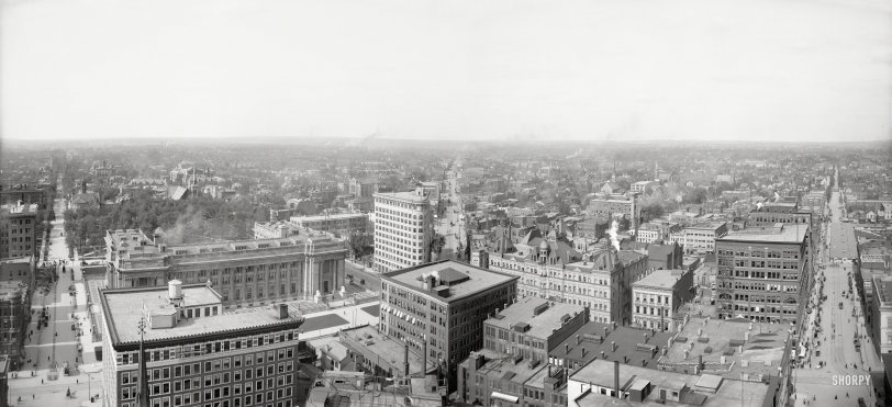
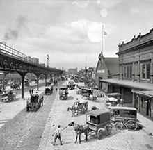
Indianapolis, Indiana, circa 1905, in a panorama made from two 8x10 inch glass plates. Who can identify the three thoroughfares? View full size.
Re: Building in street?
Across the narrow pavement (to the left, or north, of the structure in the street is Tomlinson Hall and the Market House area ("City Market"). A city ordinance dated 1902 required that all draft animals be unhitched by 9am and 'removed from the precincts of such market', leaving the wagon parked at the market.
So I suspect this is a livery erected for the convenience of market-goers who needed to remove their animals from the market.
The tracks leading up to it are perhaps related to having horse drawn street cars but I don't know if we had those at the time. They could have been used for carts for bringing in feed and bedding or removal of what the draft animals leave behind.
Building in street?
Far right of photo - I am puzzled by this - There is a large full block long building that has been built in the street. Built right over the streetcar tracks with the trolley poles coming right through the roof of the building. Assuming that it is temporary but looks substantial. Well???
Iron roof beams
On a rooftop center right there are three exterior large iron truss arrangements - something I have never seen before. I suspect that the top floor of that building was wide open with no interior support columns, thus necessitating the roof iron. Can anyone elaborate on this unusual feature ?
Birch Bayh Federal Courthouse visible
Visible in the lower left is the Birch Bayh Federal Building and US Courthouse with University Park behind it. Pennsylvania Ave runs along the eastern side of the courthouse.
The thoroughfares
Meridian Street, Massachusetts Avenue and Market Street, from left to right. Partially visible: Ohio and Pennsylvania Streets.
3-M
That's North Meridian Street on the left, East Market Street on the right, and East Massachusetts Avenue is the diagonal in the middle. I believe this view is looking northeast from Soldiers and Sailors Monument in the center of Monument Circle.













On Shorpy:
Today’s Top 5