


Framed or unframed, desk size to sofa size, printed by us in Arizona and Alabama since 2007. Explore now.
Shorpy is funded by you. Patreon contributors get an ad-free experience.
Learn more.

- Texas Flyer wanted
- Just a Year Too Soon
- WWII -- Replacing men with women at the railroad crossing.
- Yes, Icing
- You kids drive me nuts!
- NOT An Easy Job
- I wonder
- Just add window boxes
- Icing Platform?
- Indiana Harbor Belt abides
- Freezing haze
- Corrections (for those who care)
- C&NW at Nelson
- Fallen Flags
- A dangerous job made worse
- Water Stop
- Passenger trains have right of way over freights?
- Coal
- Never ceases to amaze me.
- Still chuggin' (in model form)
- Great shot
- Westerly Breeze
- For the men, a trapeze
- Tickled
- Sense of loneliness ...
- 2 cents
- Charm City
- What an Outrage
- Brighton Park
- Catenary Supports
Print Emporium
Idyllic Avenue: 1905
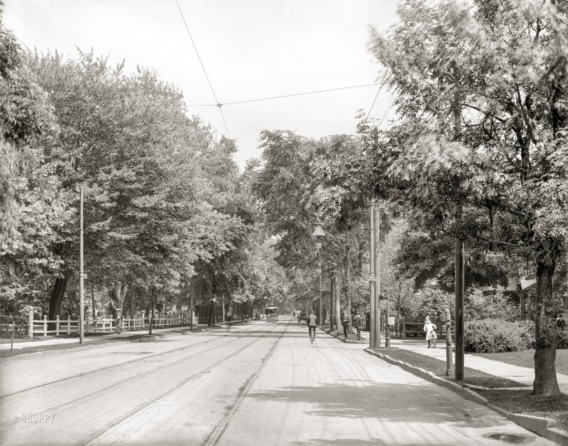
Hartford, Connecticut, circa 1905. "Farmington Avenue." 8x10 inch dry plate glass negative, Detroit Photographic Company. View full size.
It's true in almost every US city
Today, almost no one would want to build their impressive house on a street that becomes a main downtown thoroughfare. But 120+ years ago that is exactly where prosperous homeowners wanted to build. Fifth Avenue in New York and Euclid in Cleveland are two excellent examples. And today both of those streets also have almost no surviving private residences. Much beautiful residential architecture has been lost because commerce almost always triumphs and the well-to-do have the means to move on.
Cars Stop Here
In other words, that's where you catch the trolley, or get off of one.
East of Prospect Avenue
Although I can't pinpoint this location, the Sanborn fire insurance maps give some clues. The 1900 map shows Farmington developed out to about Prospect Avenue. It's residential much of the way back to the intersection with Asylum Avenue, although the lots get smaller as you head toward the river. The trees here are mature, maybe 30 or 40 years old, so unlikely to be a brand new, unmapped area, either. Somewhere between Prospect and Asylum, then.
If there were more details of the buildings, it might be possible to match the house shape and construction (plus the small cross street) with an existing building, but there's really not enough to go on here. If anyone wants to poke around, Yale University has made it easy. They have a tool that matches Sanborn maps to Google Earth. From Google Earth, you can click through to an image of each page of the corresponding Sanborn map. Here's the link for all of Yale's Connecticut maps. Scroll down for Hartford.
http://www.library.yale.edu/MapColl/print_sanborn.html
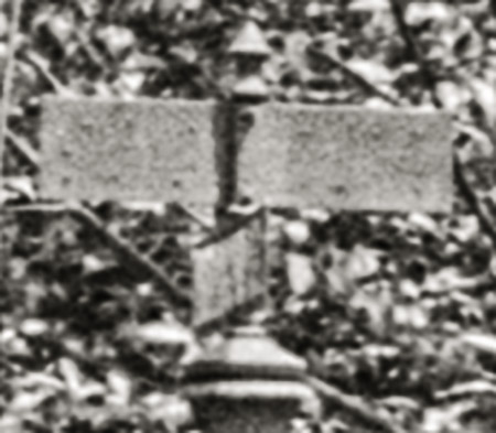
[Possible clues: Trolley pole No. 4074 at right, and the mailbox street sign. - Dave]
Too much change
Farmington Avenue has always been a major thoroughfare in Hartford. It is home to Mark Twain and Harriet Beecher Stowe's homes in the late nineteenth century- both modestly-sized but ornate residences in a neighborhood of literati. So much of the street was redeveloped, first in the 1920s, when many fine houses, mansions, and churches were torn down to make room for apartment buildings (still standing), and then again in the 1950s/60s to make way for a limited amount of strip development. I lived on Farmington Avenue for four years, and can't find a clue in this photo as to where it was taken along the street.
A few years ago the asphalt wore away in the road, revealing the buried trolley lines as well as original cobblestones. Very cool.
Give Them Clemency
Mark Twain lived on this street. While it would be nice if this scene wasn't plowed-under today and replaced with CVS's and strip malls, you can't blame anybody for progress.









On Shorpy:
Today’s Top 5