

Framed or unframed, desk size to sofa size, printed by us in Arizona and Alabama since 2007. Explore now.
Shorpy is funded by you. Patreon contributors get an ad-free experience.
Learn more.

- Indiana Harbor Belt abides
- Freezing haze
- Corrections (for those who care)
- C&NW at Nelson
- Fallen Flags
- A dangerous job made worse
- Water Stop
- Passenger trains have right of way over freights?
- Coal
- Never ceases to amaze me.
- Still chuggin' (in model form)
- Great shot
- Westerly Breeze
- For the men, a trapeze
- Tickled
- Sense of loneliness ...
- 2 cents
- Charm City
- What an Outrage
- Brighton Park
- Catenary Supports
- Just a Little Before I was Born
- Afternoon normal
- The Flat Iron Cafe survives
- Aging in Place
- Raise your hand
- Good and Bad
- Oh, the 70's
- Nooooooi
- The aluminum tubing
Print Emporium
Richmond: 1905
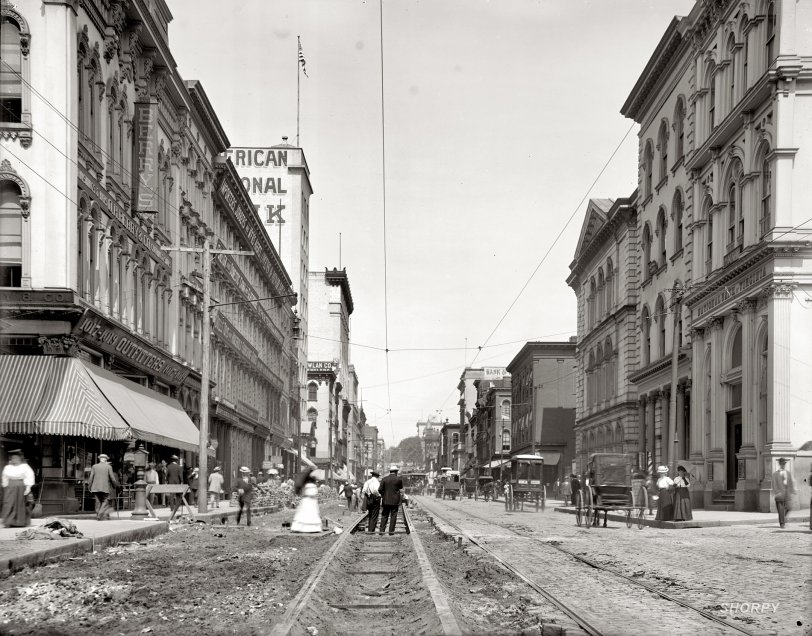
Circa 1905. "Main Street from Eleventh. Richmond, Virginia." Detroit Publishing Company glass negative. View full size.
+106
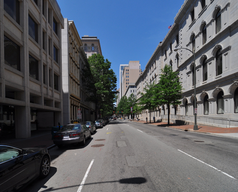
Below is the same view from April of 2011.
UO
Urban Outfitters' ancestor on the left- back when "urban" meant "dirty and crowded" instead of just "super-hip."
Relic hunters' paradise
As a Civil War historian/reenactor, I can't help but wonder how many Civil War artifacts were unearthed during the construction. After all, the photo was taken only 40 years after the war ended.
Richmond Then and Now
Which one?
I was looking on Google Maps to try and find this location, and I'm coming up empty. I can't find any "main street" in Richmond. If I assume that Main Street was renamed Broad Street somewhere along the way, Broad being the main artery through town, I can see where one of the two 11th streets hits it, but it doesn't look anything like this. I can't find evidence that any of these buildings ever existed! Did they tear them all down to build VCU?
[Below, the Google Maps view at 1048 East Main, with some of the the same buildings 100 years later. - Dave]
Richmond DOT
The worst stretch of road is on Broad, directly in front of the DOT. Amazing.
Monday, if the weather is nice, I will walk down the hill to look at this view.
There is a very small site called "Richmond Then and Now" that has captured old photos side by side with modern ones for many historic places around Richmond. Some are so unchanged from the 1860s it's amazing. My building is directly across from Jeff Davis's house; the front yard used to roll all the way down to the James River.
VDOT at work
I think I heard VDOT is scheduled to finish the repaving project on Main next year.... this shot looks like fairly early during the process, before the road started getting too bad.















On Shorpy:
Today’s Top 5