


Framed or unframed, desk size to sofa size, printed by us in Arizona and Alabama since 2007. Explore now.
Shorpy is funded by you. Patreon contributors get an ad-free experience.
Learn more.


- Alas, hidden from view
- Exclusive pump
- Details, Details
- What's that building to the left of the tower?
- Coal Barges
- Bromo-Seltzer
- Inner harbor
- The Basin
- What a headache!
- Giant stepladder?
- Baldwin 62303
- Baldwin VO-1000
- Cold
- No expense spared
- Tough Guys
- Lost in Toyland
- And without gloves
- If I were a blindfolded time traveler
- Smoke Consumer Also Cooks
- Oh that stove!
- Possibly still there?
- What?!?
- $100 Reward
- Freeze Frame
- Texas Flyer wanted
- Just a Year Too Soon
- WWII -- Replacing men with women at the railroad crossing.
- Yes, Icing
- You kids drive me nuts!
- NOT An Easy Job

Photos submitted by Shorpy members!
Print Emporium


Mouat Mine, Montana: 1942

August 1942. Stillwater County, Montana. "Development at the site of the mill for the Mouat Chromite mine. Mouat was recently constructed at the foot of one of the higher peaks in Stillwater County." 4x5 Kodachrome transparency by Alfred Palmer for the Office of War Information. Library of Congress. View full size.
Direct link?
Dave, do you know if there's a way to create a direct link to the Google Earth "view" that you create on your own screen (elevation, angle, etc.) so people could go directly to the image?
[Hmm. Not that I can see. - Dave]
Mouat Mine Today
It looks like the buildings gave way to a holding pond over the years.
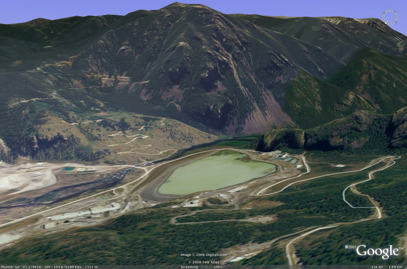
[Thanks thxdave for these great photos. Click to enlarge. - Dave]
Still there, still functioning
Note text and picture at lower left, here:
On Shorpy:
Today’s Top 5