

Framed or unframed, desk size to sofa size, printed by us in Arizona and Alabama since 2007. Explore now.
Shorpy is funded by you. Patreon contributors get an ad-free experience.
Learn more.

- Lofty addition
- In 1912
- Keenan Building
- Six years old
- Taken from the P.J. McArdle Roadway?
- It stood only 47 years
- Three track mind
- Incline to the right
- Reach for the sky, 1912 style
- No clean sweep
- Same Job Title, Same Face
- Sadly Lost
- Beautiful ...
- Where you get your kicks
- Aim High
- Pueblo Revival sisters
- Pueblo Neoclassicism
- Milk Man
- Regional dialect.
- Spielberg's inspiration
- Great Photo
- Loaf Story
- Do you still have the Rakes category?
- Could almost be a scene from the 1957 movie 'Hell Drivers'
- The Wages of Fear.
- Conspicuous by their absence
- Got Milk?
- All that aluminum
- No lefties
- Smoke 'em if you've got 'em
Print Emporium
Hurricane Slams D.C.: 1933
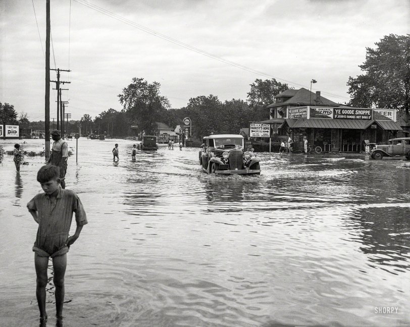
Washington, D.C., or vicinity. "Flooding." Aftermath of the "Chesapeake-Potomac" hurricane of August 1933, which led to the train wreck seen here a few days ago. Who can locate this water-logged crossroads, with "Goode Shoppe" hot dogs going for a nickel? Harris & Ewing glass negative. View full size.
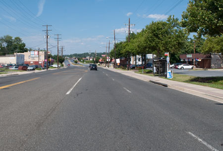
The view today
As best I can tell this is about where the photographer was standing. (Yes, I'm standing suicidally in the middle of Bladensburg Road. Fortunately, Sunday afternoon traffic is light.) Biggest difference is that the road has been diverted slightly to the left and a bank has been created along the river, for flood abatement and to allow for a ramp up to the current bridge.
A semi-related rant: I'm not only standing in the middle of the road, but in the middle of the battlefield of the Battle of Bladensburg, which is unmarked. The nearby dueling grounds get a historical marker but not the battlefield, and I'm sure that tens of thousands of people drive up and down Bladensburg Road on a typical day without realizing that they're driving through the middle of the battlefield of one of the pivotal battles of the War of 1812.
Rearranged roads
I'm going to have agree with WoodsidePark Bob: this has to be on an old alignment of Bladensburg Road, just on the Md. side of the Anacostia. If it were Baltimore Ave., then the Indian Queen Tavern would be sitting at the right edge of the frame; also, the street is way too wide. There's another clue in the map in that if you look at the current bridge approaches on the DC side, you can see that the current route swings just a little bit to the left before crossing (there's a stub of the old route still there). If you street view in the middle of the intersection along the projection of the old route you get exactly this angle.
Enlarged
I enlarged/clicked on the image, and see Peace Cross very well. I feel like I am right there, and how cool is that ? I recall Jerry's as a drive in in the early 50's. I grew up in Maryland. I will have to tell my retro buddies about this one. We thrive on such images. Thank you !
Getting a push
It looks like that big Cadillac is getting a push out of the water by a lowly Model A Ford.
Definitely Peace Cross
But the grade doesn't look steep enough to be Bladensburg Road south of the river. There are people in the distance behind the circular sign, and the water there doesn't seem any deeper than in the foreground.
If this is that stretch of the road, the grade is the reason why the American troops dug in there to prevent the British from marching on Washington, leading to the Battle of Bladensburg (200th anniversary coming up next month), which failed to stop them. They were able to break through and burn most of the public buildings in Washington.
Jerry's Hotdogs
Yes Bladensburg area, saw the sign on shop for Jerry's. Exact spot where the drive-in was.
In Maryland
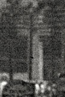
2Jim is right. The Peace Cross is in the background, so this has to be in Maryland, not D.C. Judging from the distance and angle of the cross, this was taken on Bladensburg Road just beyond the Anacostia River, looking northeast.
The Standard of the World
Lovely 1933 Cadillac convertible coupe getting a free wash. Today, it is a full Classic and similar ones sell for 100K plus.
Full Classic
That 1933 Cadillac plowing through the water is a full CCCA classic. Hard to tell if it is a V8, V12, or V16, but I'm guessing V12.
Bladensburg or Cottage City
I think I spy Peace Cross in the distant background.








On Shorpy:
Today’s Top 5