


Framed or unframed, desk size to sofa size, printed by us in Arizona and Alabama since 2007. Explore now.
Shorpy is funded by you. Patreon contributors get an ad-free experience.
Learn more.


- Roll your own
- Rugged and real!
- A Charles Purcell - Mama Cass Connection
- Uncle SAAM
- Obfuscation
- One Chocolate Soldier rode away
- Victor Marquis de la Roche
- The Little House Across Way ...
- Vanderbilt Gates
- Vanderbilt Mansion
- You can still see that gate
- Withering heights for me
- So Jim,
- Top Heavy
- Re: Can't Place It.
- Bus ID
- Since you mention it
- The White Pages ?
- Moonlight Tower
- 1907?
- Fire(men) and Water
- Can't Place It
- Can anyone
- Wings
- Where's Claudette and Clark?
- Overbuilt Rolodex
- One song
- Give Me Wings Please!
- PRR
- Pinball Wizards

Photos submitted by Shorpy members!
Printporium


Next Beer 50 Miles

February 1942. "Faulk County, South Dakota. Crossroads." Mobilgas, Standard or Hamm's? Medium format negative by John Vachon for the Office of War Information. View full size.
Busted!!
Was the owner of the car with the hood up hiding from his wife to have a quick beer? Who he now has to call for help.
More power to more people
According to the National Academy of Sciences, almost half of all farms had electricity by 1942, and virtually all by the 1950s.
http://www.greatachievements.org/?id=2990
Why am I - -
expecting a biplane to come flying over the horizon any minute?
This photograph has a landmark in it
Wally's comment about scarce rural electricity in the 1940s caused me to conclude this crossroads is not far out in the country but at the edge of the county seat, Faulkton. Much as visiting the Alamo or Great Pyramids, you get a very different photo if you do a 180 because there's a city right behind you.
Faulk county is roughly 1,000 square miles of mostly flat terrain. In 2010 the county seat of Faulkton comprised 31 percent of the county's population of 2,364. From what I can tell, Faulkton has always been the only town of any size in a sparsely populated county. The power lines support this photo was taken near there.
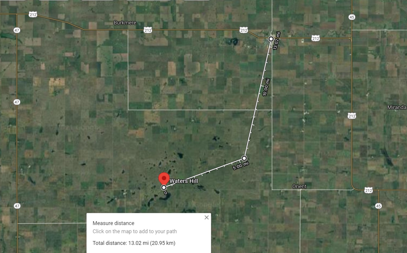
John Vachon put a county landmark in this photo, no doubt on purpose. Look into the distance to the right of the Hamm's building shadow and you'll see a hill. That is either Sugar Loaf Hill or Waters Hill, both about 430 feet high and both within 11 miles of Faulkton, easy to see across flat terrain. Sugar Loaf is closer but Waters is taller. I can't get Vachon's angle now because of construction and trees and the buildings are gone. The attached photograph shows the relationship between the three.
I change my vote - DaveA is correct. John Vachon's crossroads is just south of the town of Rockham, looking south. The landmark in the distance is probably Garfield Peak, Hand County.
No Beer, No Gas
Pretty sure this is the corner of US-212 and Broadway just outside of Rockham. The Google street view, while not of good resolution (2009), shows a good match on the old Mobil station single door, triple window building at the current NW corner. Pumps are gone, and sadly the bar/station across the road as well. Maybe in the next town we can fill 'er up, in more ways than one.
Next beer 50 miles, next gas 50 feet
Pretty amazing that -two- gas stations could stay in business at this desolate spot.
I hate raking leaves, so...
South Dakota may be the place for me.
Lady at Rest?
Is that a lady I see trying to catch 40 winks just behind the flivver?
Power to the people
It is interesting to see those power lines in South Dakota in 1942. I know people who grew up in that general area at the time who tell me that most farms did not have electricity then.
On Shorpy:
Today’s Top 5