

Framed or unframed, desk size to sofa size, printed by us in Arizona and Alabama since 2007. Explore now.
Shorpy is funded by you. Patreon contributors get an ad-free experience.
Learn more.

- Lofty addition
- In 1912
- Keenan Building
- Six years old
- Taken from the P.J. McArdle Roadway?
- It stood only 47 years
- Three track mind
- Incline to the right
- Reach for the sky, 1912 style
- No clean sweep
- Same Job Title, Same Face
- Sadly Lost
- Beautiful ...
- Where you get your kicks
- Aim High
- Pueblo Revival sisters
- Pueblo Neoclassicism
- Milk Man
- Regional dialect.
- Spielberg's inspiration
- Great Photo
- Loaf Story
- Do you still have the Rakes category?
- Could almost be a scene from the 1957 movie 'Hell Drivers'
- The Wages of Fear.
- Conspicuous by their absence
- Got Milk?
- All that aluminum
- No lefties
- Smoke 'em if you've got 'em
Print Emporium
Turn, Turn, Turn: 1941
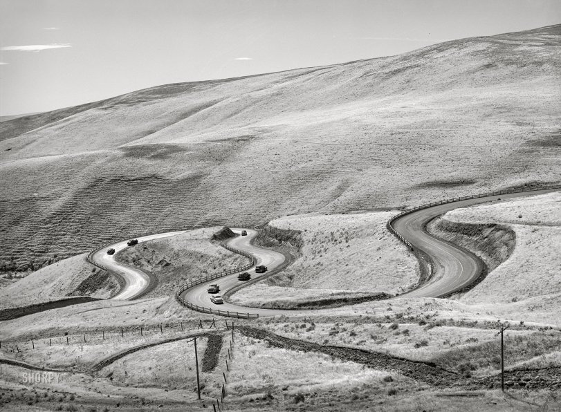
September 1941. "Highway leading down to the gorge at the Columbia River from the bench land. Klickitat County, Washington." Acetate negative by Russell Lee for the FSA. View full size.
M
For steeper slopes turns are much sharper and the road resembles zigzag pattern.
In Montenegro, one such a road had created the legend that an engineer fell in love with a local shepherdess, Maria, and could not stop "writing" her initial at the slope of the mountain.
Great composition of a three distinctive fields of foreground, distant hill and the sky.
Pick your poison
Heading south, Maryhill Loops road merges into the Lewis and Clark Highway, which intersects US Highway 97, which takes you to the Columbia River. You can get there fast, or you can take the gnarly route.
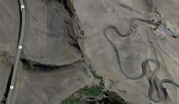
Maryhill Loops Road
US97 is now visible on the next hill, as well as many wind turbines, but the road is still there.








On Shorpy:
Today’s Top 5